Fray Bentos (Fray Bentos)
Fray Bentos is the capital city of the Río Negro Department, in south-western Uruguay, at the Argentina-Uruguay border, near the Argentine city of Gualeguaychú. Its port on the Uruguay River is one of the nation's most important harbours. The city hosts the first campus of the Technological University, beside the historically relevant industrial complex Anglo, a World Heritage site.
One of the biggest pulp mills in the world is situated close to Fray Bentos and the Libertador General San Martín Bridge; it was the center of the largest political dispute between Uruguay and Argentina during the 21st century.
The city is close to the border with Argentina and about 160 km due north of Buenos Aires, and 309 km north-west from Montevideo, Uruguay's capital.
Map - Fray Bentos (Fray Bentos)
Map


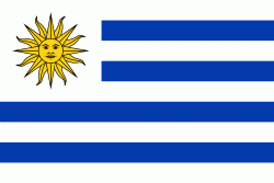
Country - Uruguay
 |
 |
| Flag of Uruguay | |
The area that became Uruguay was first inhabited by groups of hunter–gatherers 13,000 years ago. The predominant tribe at the moment of the arrival of Europeans was the Charrúa people, when the Portuguese first established Colónia do Sacramento in 1680; Uruguay was colonized by Europeans late relative to neighboring countries. The Spanish founded Montevideo as a military stronghold in the early 18th century because of the competing claims over the region. Uruguay won its independence between 1811 and 1828, following a four-way struggle between Portugal and Spain, and later Argentina and Brazil. It remained subject to foreign influence and intervention throughout the 19th century, with the military playing a recurring role in domestic politics. A series of economic crises and the political repression against left-wing guerrilla activity in the late 1960s and early 1970s put an end to a democratic period that had begun in the early 20th century, culminating in the 1973 coup d'état, which established a civic-military dictatorship. The military government persecuted leftists, socialists, and political opponents, resulting in deaths and numerous instances of torture by the military; the military relinquished power to a civilian government in 1985. Uruguay is today a democratic constitutional republic, with a president who serves as both head of state and head of government.
Currency / Language
| ISO | Currency | Symbol | Significant figures |
|---|---|---|---|
| UYU | Uruguayan peso | $ | 2 |
| ISO | Language |
|---|---|
| ES | Spanish language |